• Don't miss out on all the fun! Register on our forums to post and have added features! Membership levels include a FREE membership tier.

Inviting all sledders to West Yellowstone

Thread Rating
5.00 star(s)
M

MTdream

Well-known member
Nov 28, 2007
2,548
541
113
I have not spoken to him yet, got to figure out what day the bro in law wants to rent...he is wanting to take an 800 dragon out, and an XP..do you know if he has 800 dragons or just 700's like on his site? Sent him an email...I assume he will let us trailer the sled to cabin creek or somewhere beside riding the trails around west...
 
I have not spoken to him yet, got to figure out what day the bro in law wants to rent...he is wanting to take an 800 dragon out, and an XP..do you know if he has 800 dragons or just 700's like on his site? Sent him an email...I assume he will let us trailer the sled to cabin creek or somewhere beside riding the trails around west...


mtd,
im not sure about the dragons... i would call him instead of email. i sent him an email and he didnt respond. just tell him jesse told you to call, hell give you a deal..... he doesnt care what you do with em, im sure he will let you trailer..
 
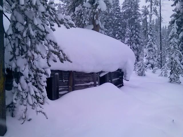
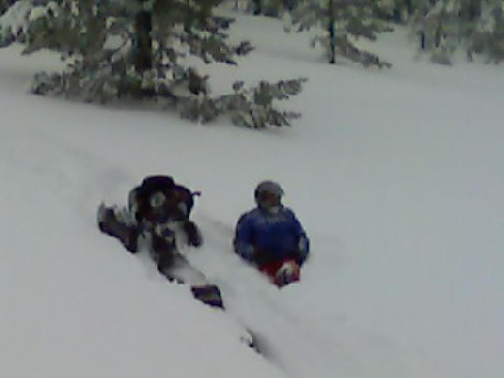
Not the best as they are from a phone...................
12-22-07_1515.jpg
 

Big D rmk700

Well-known member
Lifetime Membership
Dec 3, 2001
1,084
167
63
New Ulm, Mn
Johnson's Draw

That is usually my first stop ever year looks a lot better then last year. Save some of the powder for us, sounds like your going to get more before we get there. Should be in town around 10am on the 26th.
See Everyone Soon
D
 
S
Nov 26, 2007
29
1
3
Spicer, MN
Goin out plowing all night tonight. I guess that means only 4 more sleeps til we get to west...Woo Hoo... Just have to pray for good roads for the drive out on Thursday night!! *DANCE*DANCE*DANCE*
 
:D :beer;

Snow and Blowing Snow Advisory

URGENT - WINTER WEATHER MESSAGE
NATIONAL WEATHER SERVICE GREAT FALLS MT
400 PM MST SUN DEC 23 2007

MTZ008-015-055-241230-
/O.CON.KTFX.SB.Y.0010.071224T1200Z-071225T0600Z/
BEAVERHEAD-MADISON-GALLATIN-
INCLUDING THE CITIES OF...DILLON...ENNIS...BOZEMAN..
WEST YELLOWSTONE
400 PM MST SUN DEC 23 2007

...SNOW AND BLOWING SNOW ADVISORY REMAINS IN EFFECT FROM 5 AM TO
11 PM MST MONDAY FOR BEAVERHEAD...MADISON...AND GALLATIN COUNTIES..

A SNOW AND BLOWING SNOW ADVISORY REMAINS IN EFFECT FROM 5 AM TO
11 PM MST MONDAY FOR BEAVERHEAD...MADISON...AND GALLATIN COUNTIES.

TOTAL SNOW ACCUMULATIONS FROM THIS EVENING THROUGH MONDAY
AFTERNOON OF 4 TO 8 INCHES ARE LIKELY ACROSS FAR SOUTHWEST
MONTANA.. ESPECIALLY AT ELEVATIONS ABOVE 6000 FEET. LOCAL
ACCUMULATIONS UP TO 12 INCHES ARE POSSIBLE AT HIGHER MOUNTAIN
PEAKS. WESTERLY WINDS OF 15 TO 25 MPH WITH GUSTS TO 35 MPH WILL
CREATE BLOWING AND DRIFTING SNOW AT TIMES...AND REDUCED
VISIBILITIES...ESPECIALLY THROUGH THE MOUNTAIN PASSES.

A SNOW AND BLOWING SNOW ADVISORY MEANS THAT VISIBILITIES WILL BE
LIMITED DUE TO A COMBINATION OF FALLING AND BLOWING SNOW. USE
CAUTION WHEN TRAVELING...ESPECIALLY IN OPEN AREAS.

$$
 
Winter Storm Warning

URGENT - WINTER WEATHER MESSAGE
NATIONAL WEATHER SERVICE GREAT FALLS MT
342 AM MST MON DEC 24 2007

MTZ008-015-055-242100-
/O.EXB.KTFX.WS.W.0016.071224T1200Z-071225T0600Z/
/O.CON.KTFX.SB.Y.0010.071224T1200Z-071225T0600Z/
BEAVERHEAD-MADISON-GALLATIN-
INCLUDING THE CITIES OF...DILLON...ENNIS...BOZEMAN..
WEST YELLOWSTONE
342 AM MST MON DEC 24 2007

...WINTER STORM WARNING IN EFFECT UNTIL 11 PM MST THIS EVENING
FOR ELEVATIONS ABOVE 7000 FEET AND SOUTHERN PORTIONS OF BEAVERHEAD..
MADISON...AND GALLATIN COUNTIES..
...SNOW AND BLOWING SNOW ADVISORY REMAINS IN EFFECT UNTIL 11 PM
MST THIS EVENING FOR THE NORTHERN PORTIONS OF
BEAVERHEAD...MADISON...AND GALLATIN COUNTIES BELOW 7000 FEET..

THE NATIONAL WEATHER SERVICE IN GREAT FALLS HAS ISSUED A WINTER
STORM WARNING...WHICH IS IN EFFECT UNTIL 11 PM MST THIS EVENING FOR
ELEVATIONS ABOVE 7000 FEET AND SOUTHERN PORTIONS OF BEAVERHEAD..
MADISON...AND GALLATIN COUNTIES.
A SNOW AND BLOWING SNOW ADVISORY REMAINS IN EFFECT UNTIL 11 PM
MST THIS EVENING FOR THE NORTHERN PORTIONS OF
BEAVERHEAD...MADISON...AND GALLATIN COUNTIES BELOW 7000 FEET.

TOTAL SNOW ACCUMULATIONS THROUGH THIS EVENING OF 5 TO 9 INCHES ARE
LIKELY ACROSS MOST OF FAR SOUTHWEST MONTANA.. ESPECIALLY AT
ELEVATIONS ABOVE 7000 FEET. LOCAL ACCUMULATIONS UP TO 12 INCHES
ARE POSSIBLE AT HIGHER MOUNTAIN PEAKS. VALLEY AREAS IN NORTHERN
PORTIONS OF BEAVERHEAD...MADISON...AND GALLATIN COUNTIES WILL ONLY
RECEIVE 2 TO 5 INCHES. MUCH OF THE SNOW IS EXPECTED TO FALL THIS
MORNING AND EARLY THIS AFTERNOON...WITH PERIODS OF HEAVY SNOW
LIKELY. WESTERLY WINDS OF 15 TO 25 MPH WITH GUSTS TO 35 MPH WILL
CREATE BLOWING AND DRIFTING SNOW AT TIMES...AND REDUCED
VISIBILITIES...ESPECIALLY THROUGH THE MOUNTAIN PASSES.

A WINTER STORM WARNING MEANS SIGNIFICANT AMOUNTS OF SNOW..
BLOWING SNOW...AND WIND ARE EXPECTED OR OCCURRING. THIS WILL MAKE
TRAVEL VERY HAZARDOUS OR IMPOSSIBLE.
 
Ummm...is that too much snow? PSYCH!!

I know Willy will see this. Ed and Too Tall, probably not. But...SLED DOGS...READY...GET SET...Jan. 10-12 is when we're coming out. Thanks to all who've gone before us and share pics here. Gits my adrenaline flowing.
 
T
Nov 26, 2007
133
0
16
Helena,MT
Only 5 more sleeps until Team Mugad invades West Yellowstone. So where is the big new years party at this year? More then likely you can find us at Strozzies every night.

Kory
 
Premium Features