
POWDER ALERT: Winter Chaos - Several MORE Feet Expected!
PowderchasersJan 15, 2024
Winter madness continues this week in the Western US, bringing significant snowfall to nearly every corner of the West.
LLC remains closed early Monday morning with wind gusts at Hidden Peak (11K) in the 70-90 mph range. We are not confident on an early opening of the Canyon if at all today (Earliest will be 10-11).
Utah resorts picked up another 10-15" overnight, and Colorado resorts did exceptionally well, with reports ranging from 5 to 20+ inches (21 at Winter Park, 20 at Eldora).
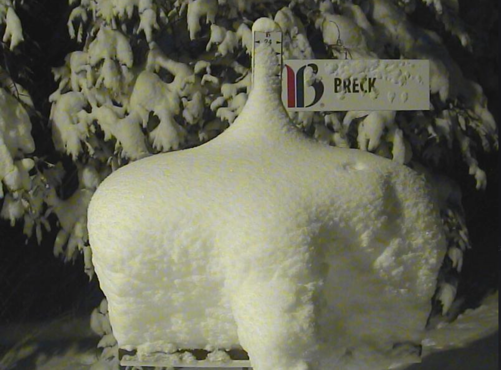
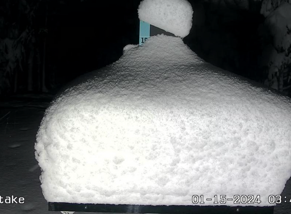
Check out some pretty incredible snow stakes from this morning in Colorado (Breck and Copper):

In the short term, lingering precipitation will bring a few more inches to Utah and Colorado, adding to already impressive storm totals. Unfortunately, strong winds out of the northwest will likely bring upper-mountain lift wind holds and prevent lots of expert terrain at the top of resorts from opening.
As of 4AM on Monday gusts at Hidden Peak at Snowbird were near 100MPH.
Winds are very strong along the Utah and Colorado mountain regions. Expect delays in openings or non openings in upper terrain.
Below: Snowfall totals from Sunday to Monday! WOO HOO, Most of Colorado is getting crushed (Finally for Summit County). 15-20 being reported at many resorts along the I-70 corridor.

Below: Copper Mountain is buried.
Looking ahead, the next system will move onto the northern California coast on Tuesday afternoon, pushing west and northwest into the intermountain west on Tuesday night, Wednesday, and Thursday.
Below is a brief synopsis of the storm for each region:
CASCADES:
Precipitation begins Tuesday evening in Oregon and works its way north. By Wednesday morning, the Oregon Cascades will have picked up 5-10” and Washington resorts will have accumulated 3-6”. Temperatures during this whole storm will be borderline and will bring fairly dense snow to resorts in southern Washington and Oregon (south of Alpental/Crystal)... potentially rain above 4,000-4,500 feet at Oregon resorts especially on the tail end of the storm on Wednesday night.
Below, notice the lower-tropospheric temperature anomalies showing warm southwesterly flow in and west of the Cascades with cold air pooling on the east side of the Cascades:

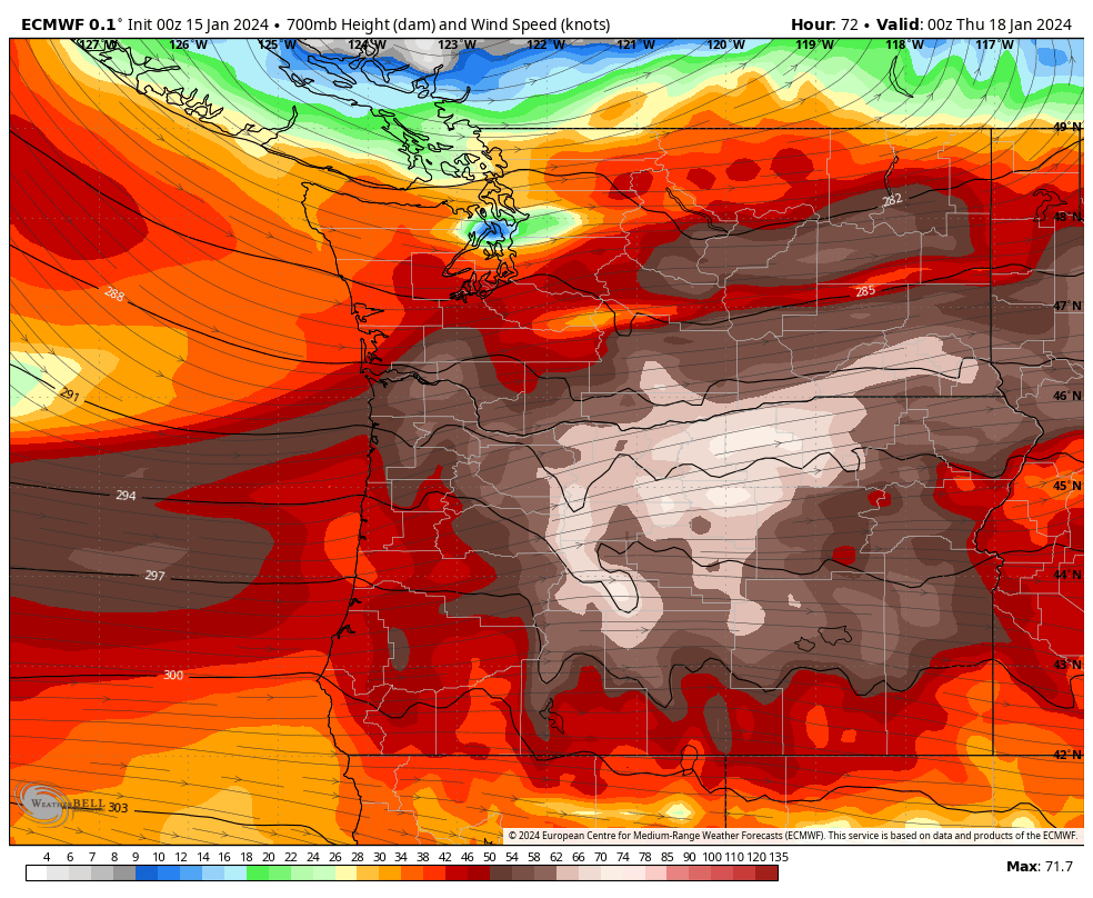
Strong snowfall will continue on Wednesday and drop significant additional snow with totals during the day ranging from 6-12”. Winds will be extraordinarily strong on Wednesday with the jet directly overhead and will prevent upper mountains from running smoothly… keep that in mind if you’re planning a chase.
Check out the truly impressive lower jet in Washington and Oregon on Wednesday... this will make opening upper mountains difficult if not impossible with strong wind.
Lingering snowfall will continue to bring a few inches through the end of the week.
ANNOUNCEMENT- Selkirk Powder Cat Skiing is now open with plenty of powder and more to come this week. Mention "Powderchasers" when booking and receive a free swag bag from us. They are about to get blasted with more powder this week. They are in the zone this week and the previous storms with plenty of good quality powder currently. Seats are filling up fast.


UTAH:
This storm will hit pretty hard and fast in Utah, lasting from Wednesday morning through Wednesday night. Most of this snow will fall during the day on Wednesday, with 8-14” for resorts. Wednesday night will bring another several inches and keep things fresh and deep for Thursday. Wednesday will be windy on higher terrain, so it’s doubtful that much upper-mountain terrain will open during the day. However, winds calm down overnight, so Thursday is likely the best day to target for scoring steep and deep runs when the upper-mountain lifts are able to operate.
COLORADO:
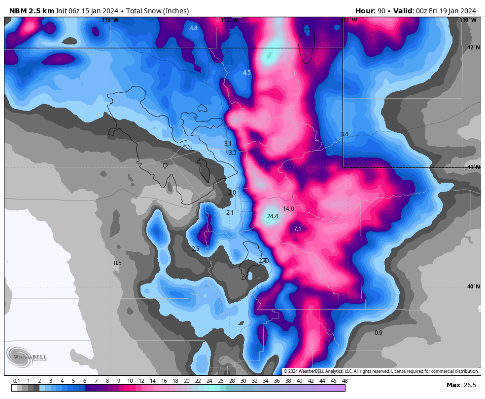
Snowfall in CO will last from Wednesday morning through Thursday night and will primarily affect the central and northern mountains. We’re likely looking at 10-18” at Steamboat, 3-5” for northern mountains & I-70 resorts (deepest totals at Vail), and 3-6” for the central mountains (deepest totals at Aspen). Winds should be a little bit calmer, so upper mountains should be able to operate without wind holds.
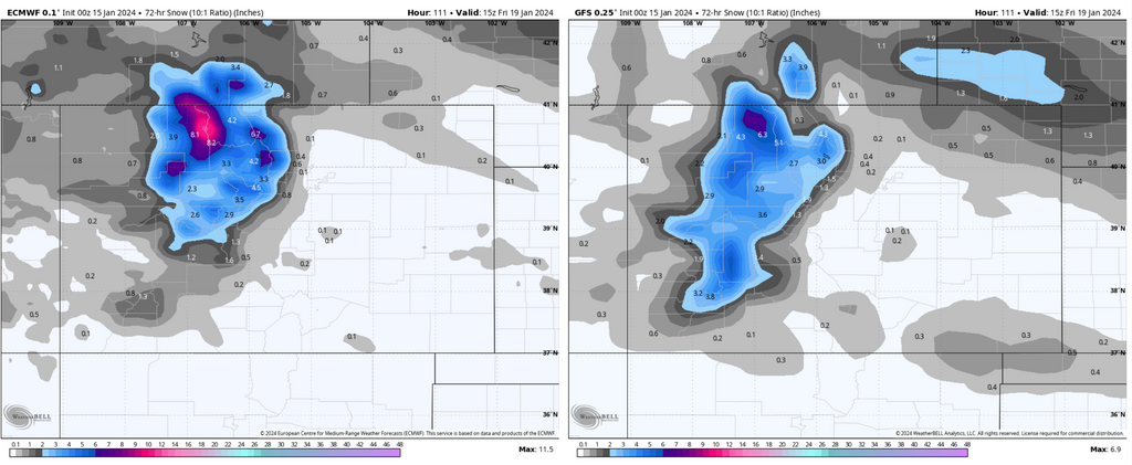
Below: the European (left) and American (right) models showing this system for Colorado... the ECMWF keeps the snowfall relegated a bit further north while the GFS gives a little more love to the central and southern mountains and distributes things more evenly. Either way, both of these maps are likely underestimates, since these assume a 10:1 snow ratio despite cold temperatures almost ensuring the actual snow ratios will be higher than 10:1.
TETONS:
The Tetons will see snowfall from Tuesday night through Thursday, with most falling on Wednesday and Wednesday night (best day for powder chasing will be on Thursday). Likely 10-20" storm totals. Winds are not expected to be a significant factor for lift delays and terrain openings.
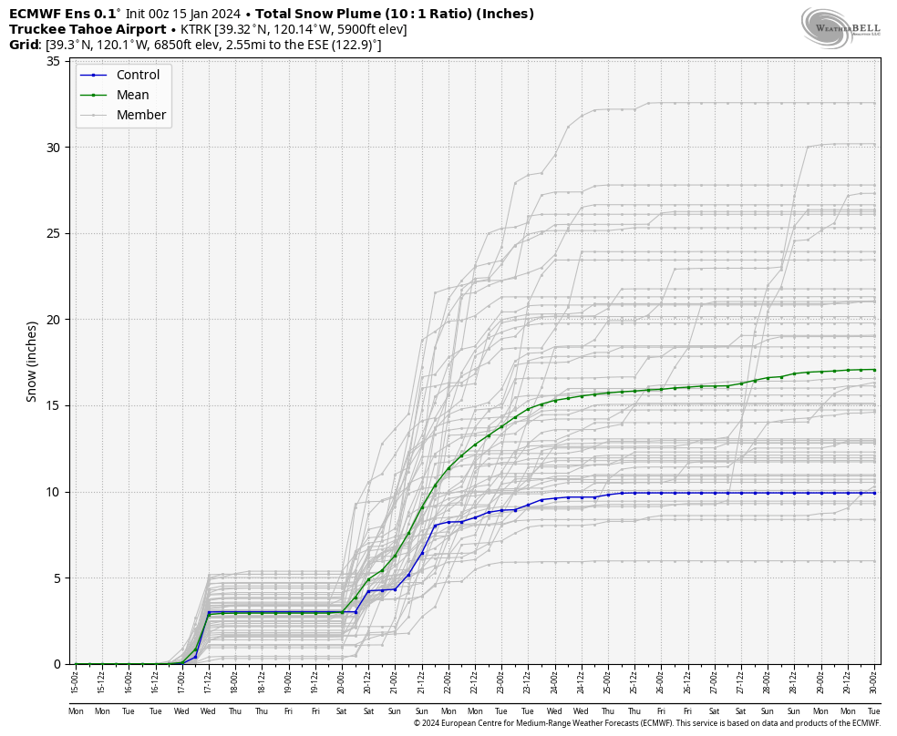
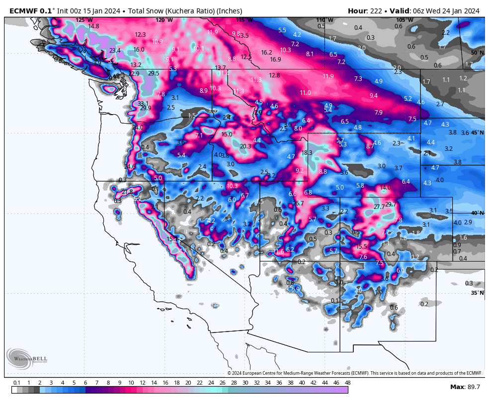
Looking ahead, models are indicating the pattern switching to a stronger subtropical jet, which, if it pans out, will hammer moisture into the Sierra into early next week. Time will tell how long this pattern sticks around, but it does look like the Sierra could do very well this weekend.
Below: an intriguing weekend and start to next week for California...
Help us out!
If you want to chase powder with Powderchasers sign up for the concierge package for the deepest resorts to chase to and 1:1 custom forecasting with our staff. Also, if you have read this far, please donate to continue receiving these free forecasts. We appreciate the community support. You won't regret chasing with our custom forecasts. We have new swag on the Powderchasers storefront and all larger donations include it.
Follow us on Instagram and Facebook @powderchasers
Enjoy the powder, everyone! Remember, your deepest resort is not always the best chase. See you in the first chair somewhere on Monday.
POWDER ALERT: Winter Chaos - Several MORE Feet Expected!
Winter madness continues this week in the Western US, bringing significant snowfall to nearly every corner of the West. LLC remains closed early Monday morning with wind gusts at Hidden Peak (11K) in the 70-90 mph range. We are not confident on an early opening of the Canyon if at all today...

