
New Forecast Reveals Strong El Niño May Boost Wintery Activity Across Mid-Atlantic
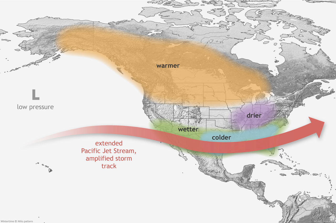
SUNDAY, NOV 05, 2023 - 10:10 AMA newly published forecast map from the National Oceanic and Atmospheric Administration reveals that the El Niño weather pattern might bring increased snowfall to regions such as the Sierra, the southwestern mountains, the Plains, and the Mid-Atlantic states. This forecast aligns with the typical southward shift of the jet stream during an El Niño event, which usually carries more moisture and precipitation along the southern tier of the US.
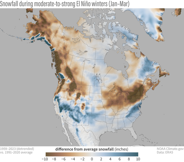
The map below shows snowfall totals for past moderate-to-strong El Niños. Notice how wetter-than-average conditions are shown across the southern Plains, Southeast, Gulf Coast and Mid-Alantic. While drier-than-average conditions are expected across parts of the Midwest, Pacific Northwest, and interior Northeast.
"An enhanced southern jet stream and associated moisture often present during strong El Nino events supports high odds for above-average precipitation for the Gulf Coast, lower Mississippi Valley, and Southeast states this winter," Jon Gottschalck, chief of the Operational Prediction Branch of the Climate Prediction Center, wrote in a report.
Although actual snowfall depends on many factors, the latest forecast indicates that El Niño, the first in four years, might be a change for residences in Washington, DC, Baltimore, Philadelphia, and New York City. These areas have experienced several years of La Niña conditions, which have resulted in winters with minimal snowfall.
Here's what the weather community on X is saying about this upcoming winter:
New Forecast Reveals Strong El Niño May Boost Wintery Activity Across Mid-Atlantic | ZeroHedge
ZeroHedge - On a long enough timeline, the survival rate for everyone drops to zero
 www.zerohedge.com