
/cdn.vox-cdn.com/uploads/chorus_asset/file/25249728/246961_Costa_Rica_Renewables_3_IVargas.jpg)
What happens after your country runs on 99 percent renewable electricity?
Costa Rica runs almost entirely on renewables, but climate change poses new risks.
A lot of good that must do when over a million live in poverty.
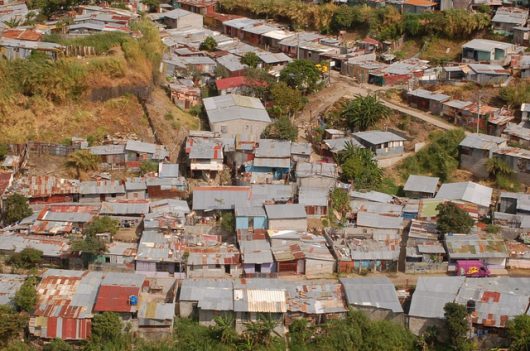
10 Facts about Costa Rica Slums - The Borgen Project
Costa Rica slums are as problematic as any in Central America. The peaceful nation has made progress in combatting poverty...
Tourist attractions, is this like don't feed the monkeys.


")
