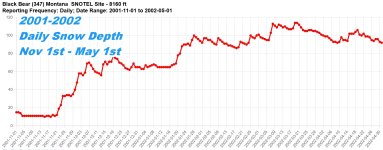
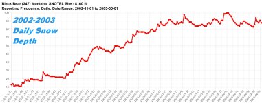
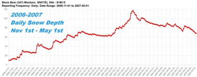
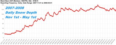
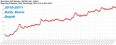
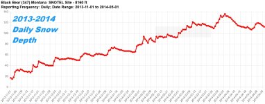
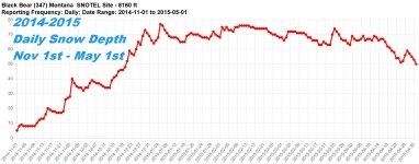
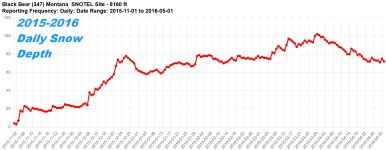
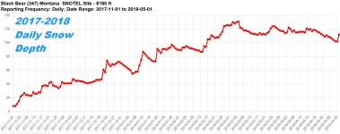
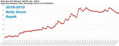
I was doing a little research this morning to see what we have left of our season for Island Park. So I went through the last 25 years of SnoTel data and compiled some charts. These are for the Island Park Black Bear sensor, so this would be the HIGHEST readings for all of Island Park.
Each screen is Auto-Sized for itself, so the peaks are NOT relative to each other, each chart can represent a SIGNIFICANTLY different amount of snow from one year to another!
But the 10 year pattern does show some predictability on peak snow and when the big melt-off comes.
Each screen is Auto-Sized for itself, so the peaks are NOT relative to each other, each chart can represent a SIGNIFICANTLY different amount of snow from one year to another!
But the 10 year pattern does show some predictability on peak snow and when the big melt-off comes.


