
October-December 2020 North American jet stream approximation. Photo credit: Clay Malott
As skiers in the Pacific Northwest rejoice over their abundant snowfall, Colorado and Utah skiers are making their yearly sacrifices to Ullr a bit late. Why have Colorado and Utah been so late to receive typical winter snowfall?
The culprit: La Niña. However, La Niña itself isn’t directly responsible. Rather, it is La Niña’s tardiness that is causing the dismal snowfall numbers.
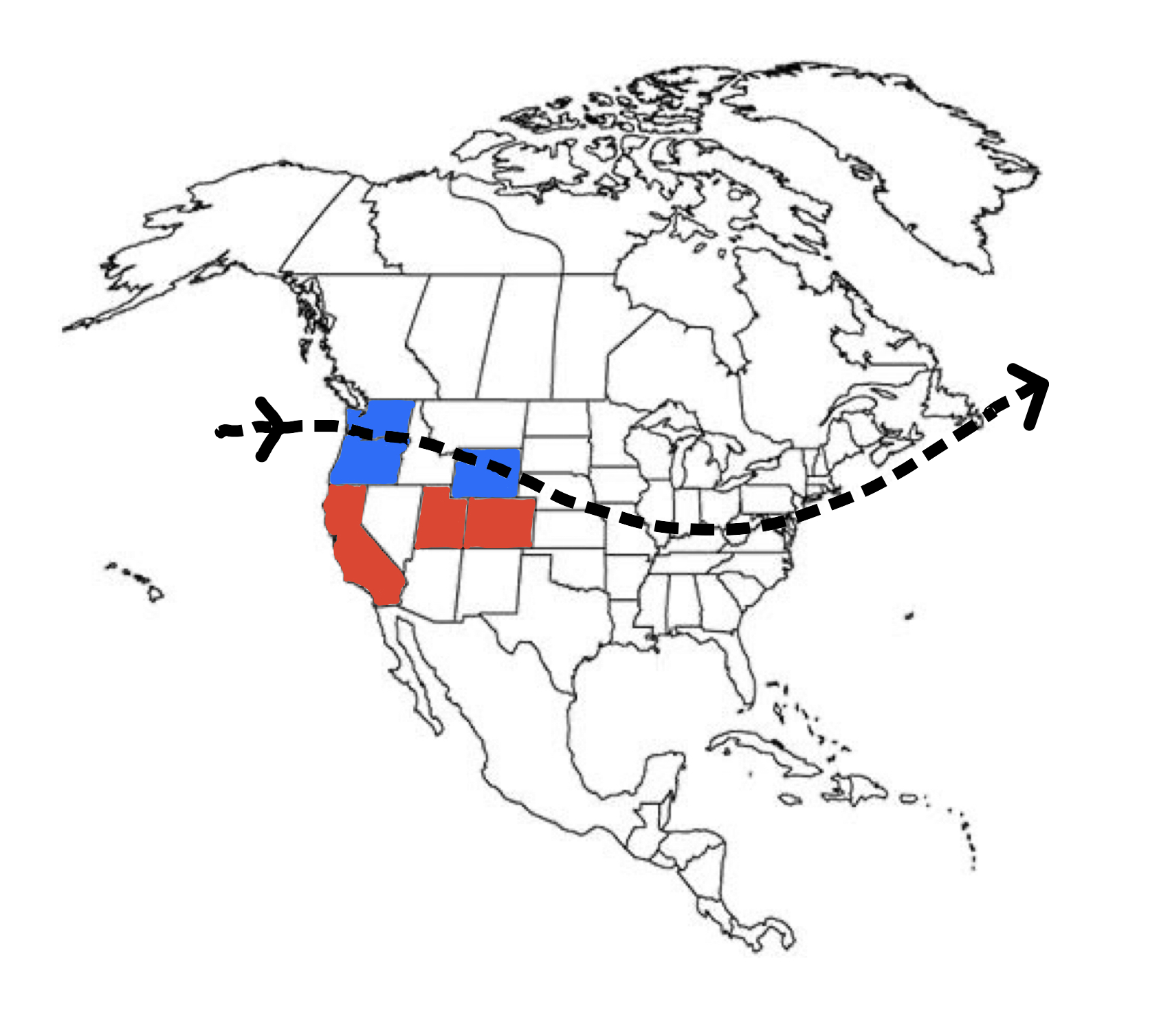
Thus far this season, the jet stream, which is responsible for all of North America’s weather, has been far further north than it typically is during such a strong La Niña pattern. Above is an approximate map of the jet stream so far this season and the effect that it has had on snowfall
It becomes clear that the jet stream is missing the Sierra, Wasatch, and Rockies by a pretty good margin. This means fewer storms and less snow for these regions. However, not all hope is lost. Below is a 240-hour run of the GFS cyclonic vorticity forecast:
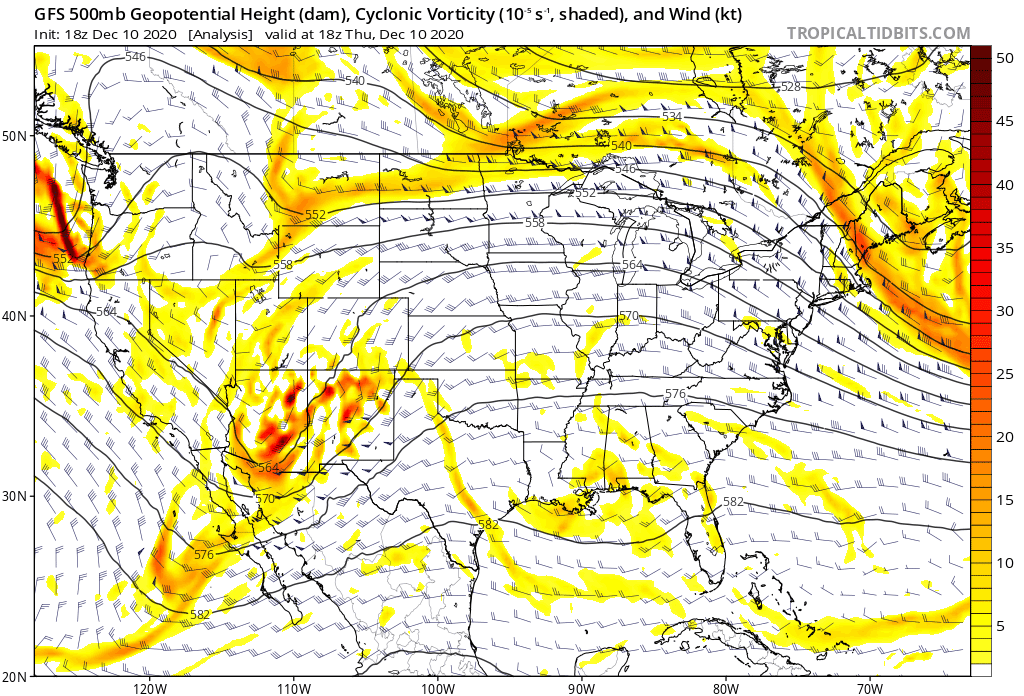
As you can see, even in the next 10 days, this pattern is beginning to shift to a typical winter flow.
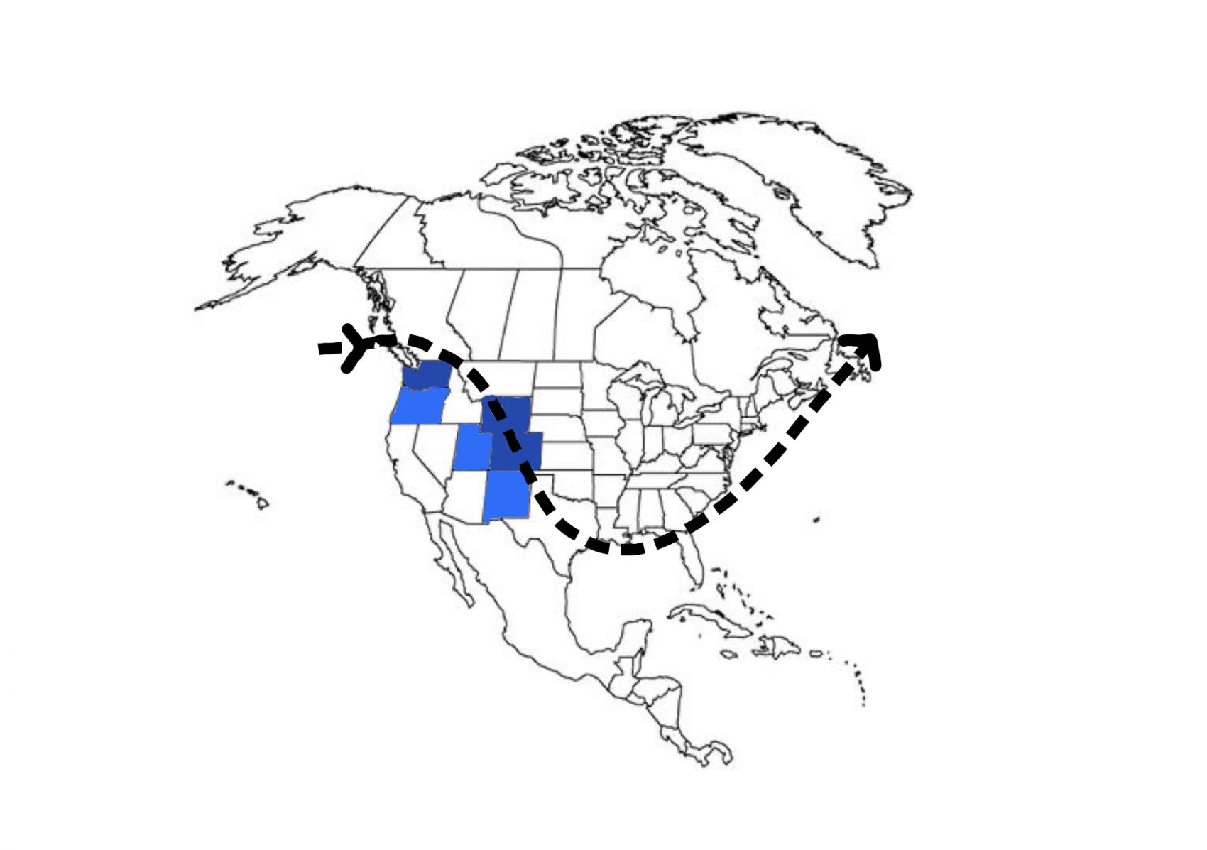
In my opinion, using several long-range models and historical data, this marks the beginning of La Niña 2020 falling into a consistent winter flow. This is great news for the currently dry regions like Utah and Colorado. If the jet stream pattern moves and stays south, Colorado and Utah will receive small, consistent dumps of snow, perfect for building a solid early season base and keeping avalanche risk to a minimum.
If this pattern stays south (which it should), the new jet stream/snowfall map should look something like this:
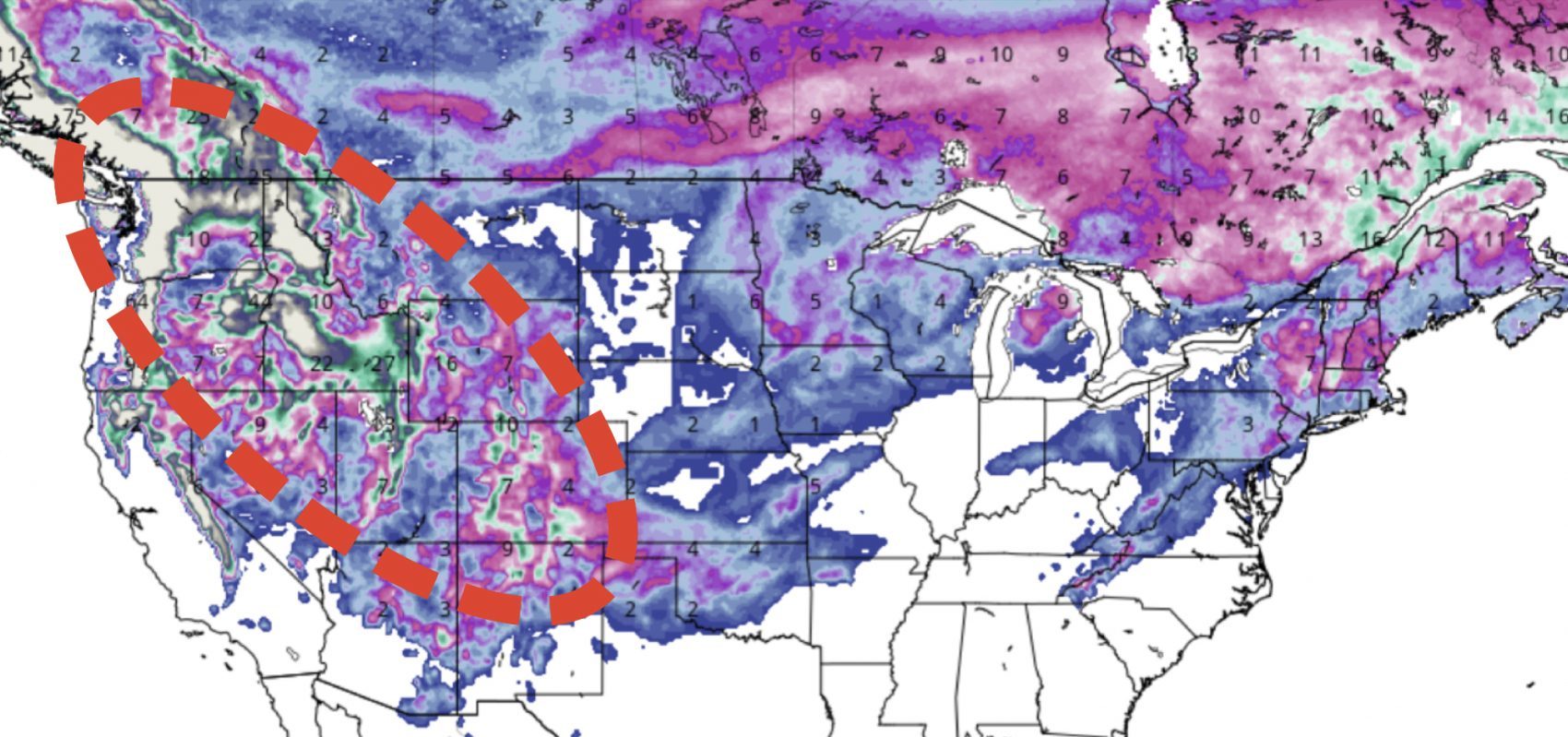
Overall, this is great news for pretty much everywhere. As this pattern continues to move into a more typical southern, winter pattern, we should begin to see more and more consistent snowfall across the US.
Long Anticipated La Niña Pattern Set to Engage in Intermountain West Before Christmas - SnowBrains
As skiers in the Pacific Northwest rejoice over their abundant snowfall, Colorado and Utah skiers are making their yearly sacrifices to Ullr a bit late.
 snowbrains.com