• Don't miss out on all the fun! Register on our forums to post and have added features! Membership levels include a FREE membership tier.

Trail Maps on GPS????

0

06 RMK 900

Well-known member
Oct 20, 2008
1,621
343
83
35
Mandan, North Dakota
Does anyone know of a web site or program where you can upload trail maps either off the internet or just a paper copy of a map on to a gps?
 
W
Jan 2, 2008
1,927
223
63
I'd like to find this as well

what I've been doing is uploading from google earth onto my Rino 530hcx.

I can take a FS trail map from someplace I've never been and trace it to google earth, then make my trail and transferr that to my Rino software then finally x-fer that to my Rino.


Its a PIA and time consuming.


thing I can't do is trace where a snowmobile trail leaves a known FS road and goes "cross country" then I have big blank spots.
 
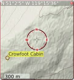
I run TrekBuddy on my blackberry. TrekBuddy is a great, freeware application developed by Kruch a Czech developer. With TrekBuddy you can use offline maps, from Google and elsewhere, record route speed and waypoints, or use your phone as a direction finder. Here is a screen shot:

tn_beach_bums-wallpaper.jpg


Whoops wrong screen shot.....

tn_bbscreen.jpg


Try Dootalk. I know there is a site out there but mostly eastern trails. I have one on http://www.everytrail.com of the North Shuswap.
 
Premium Features